
Rail Crossing Atlasby Tan Solutions
U.S. railroad crossings, straight from the federal record.
An atlas of U.S. railroad crossings built from the Federal Railroad Administration’s crossing inventory: 203,136 crossings open at track level, in the inventory of 3 November 2026. Public records by state and crossing guides are open to everyone. Free to read; no account needed for records.

FRA highway-rail crossing inventory
U.S. grade crossings in the FRA inventory, one point of light each
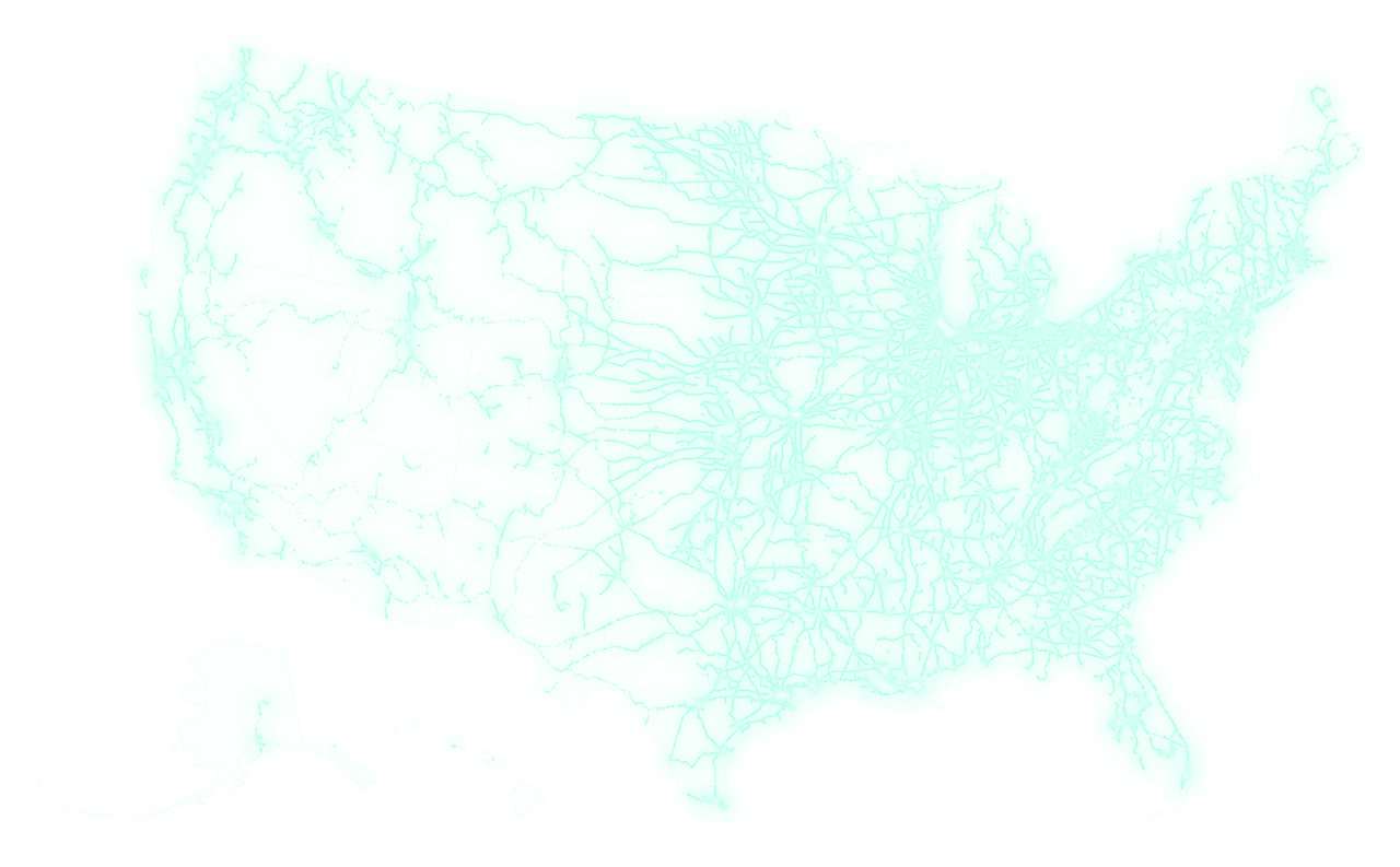
203,235crossings on this map
202,487 with a mapped location · drawn from the FRA crossing inventory of 4 October 2026
Inventory of 3 November 2026: 203,136 crossings
What it does
Look up any crossing
Search by the DOT crossing number, a road, a city or a railroad. Each crossing gets a page you can read: where it is, whether it is public or private, its warning devices and the trains and road traffic last reported.
Browse state by state
Open a state to see all its crossing records, with counts of how many have usable map locations, road counts and train counts. Every state and the District of Columbia is there.
Keep every date
Each figure keeps the date of the inventory it comes from, here the inventory of 3 November 2026. The sources are linked, and the limits of the records are spelled out.
Who it is for
- Residents who want to know about a crossing near them.
- Local officials and reporters who need the federal record for a crossing.
- Rail fans who follow lines and crossings state by state.
How it works
- Open the atlas, or search for a crossing by its DOT number, road, city or railroad.
- Read the record: location, type, warning devices and reported traffic, each with its date.
- Follow the links to the federal source, or create a free account for the interactive map and compare.
Chicago, crossing by crossing
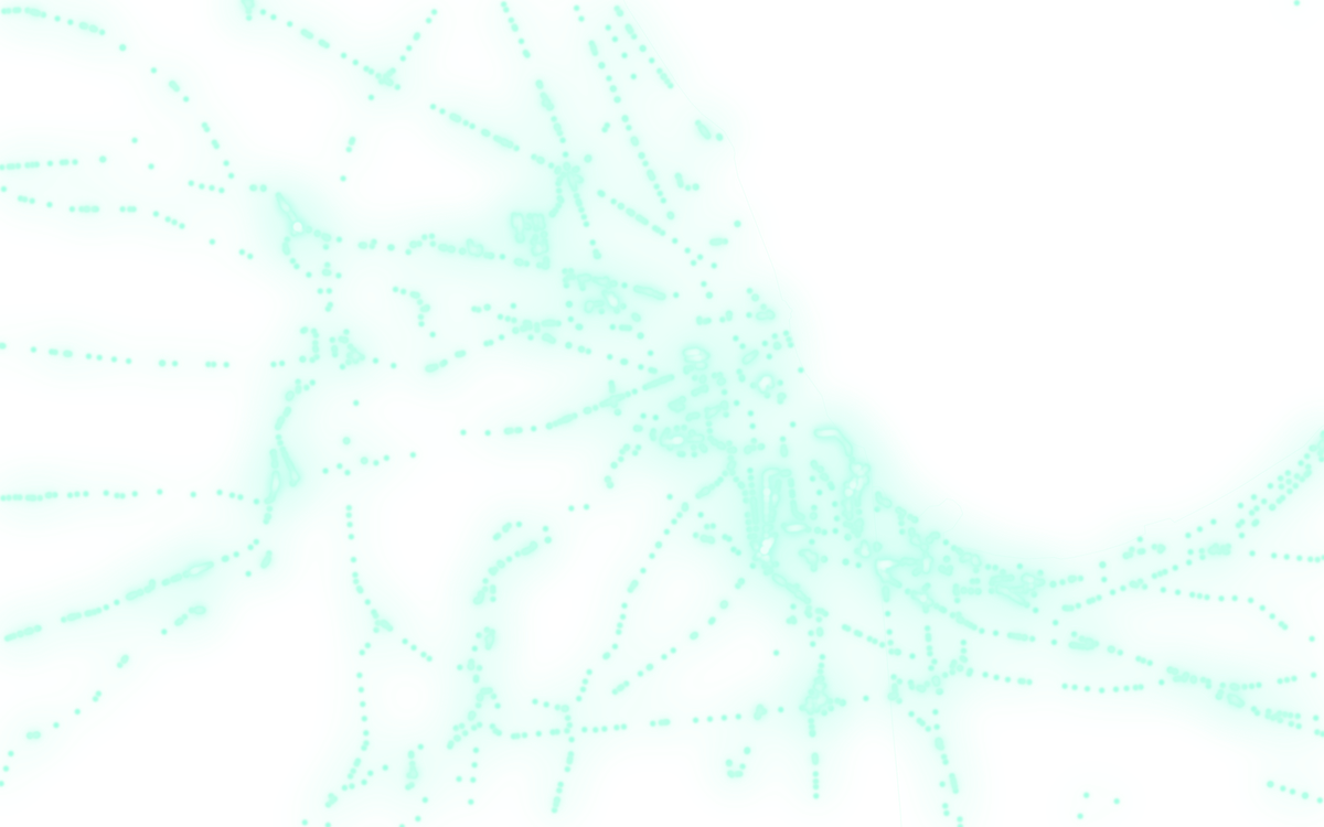
Zoom in on Chicago, where lines from every direction meet, and the network turns into single crossings: 2,463 of them in this window, about 150 km across, from Chicago’s northern suburbs to northwest Indiana. Each point sits where its FRA record places it.
The live atlas, on a phone
Three public pages as they appear today. No account needed for any of them. Captured .
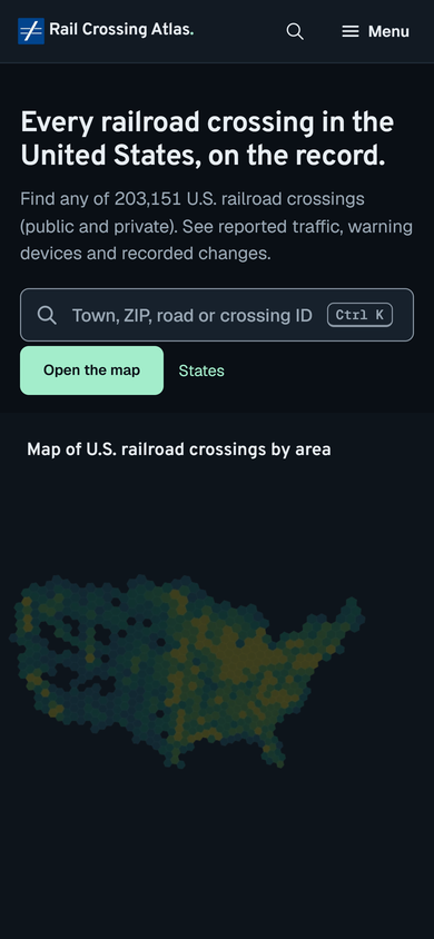
Search or pick a state
Search by crossing ID, road, city or railroad, or start from the map of states.
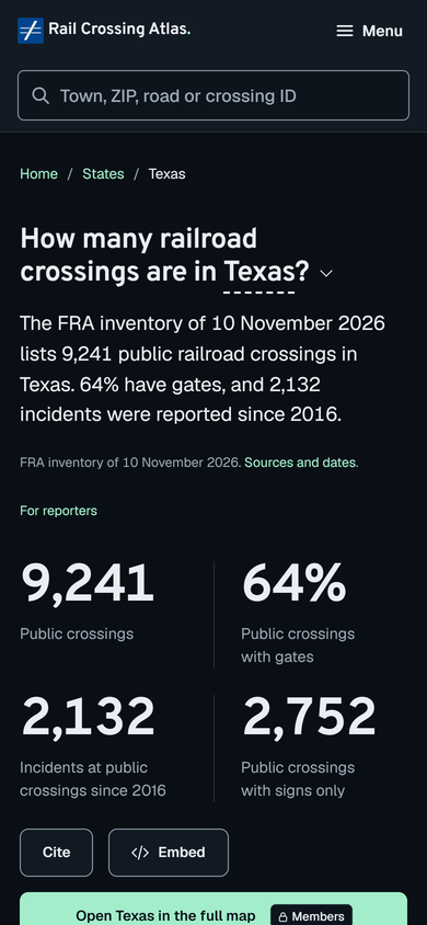
Open a state’s public records
Each state page lists its crossing records and shows how many have usable locations, road counts and train counts.
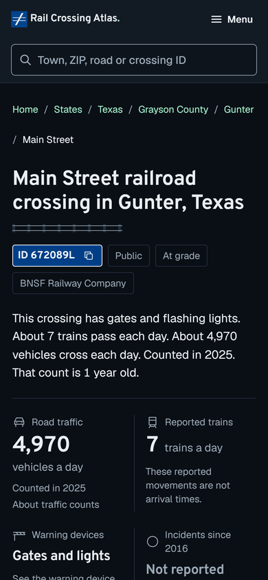
Read one crossing
A record page shows what the inventory says about one crossing, with the date of the report it comes from.
Notes on the crossing records
The atlas's guides are short. These notes from Tan Solutions go further into how the federal inventory is kept and how to read a record, with sources for every rule and figure.
- Who looks after a U.S. railroad crossing, how the record names them, and what the rules require after a callPublished · The railroad, the road authority and the state office behind each crossing, the three numbers on its record, and what the federal rules require when someone calls.
- The road at a railroad crossing: surface, angle, lanes, speed limit and road class in the federal inventoryPublished · What Parts IV and V of a crossing record say about the road itself, from the surface and the angle to the speed limit and the road class, and how complete those fields are.
- Section 130 and the Railroad Crossing Elimination Program: what they fund and who takes partPublished · The formula funds every State receives under Section 130, the FRA's competitive crossing grants, who takes part in each, and where the inventory comes in.
- U.S. railroad crossings by the class of the railroad that reports themPublished · The federal railroad classes, how the crossing inventory records them, and counts of open crossings by class, by type and by Class I parent.
- What a U.S. DOT crossing number is, who assigns it and how to find oneUpdated · What the federal inventory number of a crossing looks like, who gives it, the blue sign that shows it, and how to look one up.
- How train counts are reported on a crossing record, and why they can be oldPublished · The train boxes on the federal crossing form, the year each count carries, and why a recent revision date does not mean a recent count.
- How the U.S. railroad crossing inventory is kept and updatedPublished · Who files each crossing record, the two deadlines that keep records current, and what one week of changes in the federal inventory looked like.
- Reading a railroad crossing record, field by fieldUpdated · What each part of a federal crossing record says, which form box it comes from, and how old its train and road counts can be.
- Public and private railroad crossings: where the line fallsPublished · The federal test for a public crossing, how the national total divides, why some records have no type, and which deadlines apply only to public crossings.
- Signs, lights and gates: how the crossing inventory records warning devicesPublished · The form boxes behind every statement about crossing equipment, how counts become the national groups, and the three-month rule for device changes.
- How a city sets up a railroad quiet zone under 49 CFR Part 222Published · The minimum requirements for a new quiet zone, the Notice of Intent and the establishment notice, and why every step starts with the crossing records.
- Railroad crossings state by state, and how to read the countsPublished · An alphabetical table of all and public crossings in each state, what each column counts, and how to compare two states without mixing totals.
- Closures, reopenings and bridges in the crossing recordsPublished · What counts as a closed crossing, how closures reach the record, reported closures and reopenings by decade, and the grade-separated records.
Status and dates
| Status | Public since 1 October 2026 |
|---|---|
| Inventory | The FRA crossing inventory of 3 November 2026: 203,136 crossings |
| Where it lives | railcrossingatlas.tansolutions.org |
| Price model | Free to read. A free account adds the interactive map, compare and record checks. |
| Ratings | None. The atlas shows the records; it does not rate or rank crossings. |
Related
Start with these notes, then the atlas’s own pages.
- Reading a railroad crossing record, field by field
- What a U.S. DOT crossing number is, who assigns it and how to find one
- Railroad crossings state by state, and how to read the counts
- Crossings by statePublic crossing records for every state and the District of Columbia. No account needed.
- Crossing guidesHow to find a crossing, and how to read crossing project documents.
- About the dataThe federal sources, their retrieval dates and what the records can and cannot tell you.
Questions
Where does the data come from?
From the Federal Railroad Administration’s highway-rail crossing inventory. The atlas links each source with the date it was retrieved.
How current is it?
The atlas uses the inventory of 3 November 2026. Every figure keeps that date, so you can always tell how old a number is.
Do I need an account?
Not to read records. Crossing records for every state, the record search and the crossing guides are open to everyone. The interactive map, compare and record checks need a free account.
Does the atlas rate crossings?
No. The atlas shows what the federal records say. It does not rate, rank or score crossings.
Looking for a crossing record?
Tell us which crossing, state or field you need, or what is missing from the records. Please don’t send passwords or personal data.